See each region’s evidence for historical or present-day scope.
Homeland / region
Southeast / Oklahoma / North Carolina
Research depth
Source guide
Source collection
3 annotated resources · 1 Indigenous-led
Inspected sources
0 substantive works · selected content reviewed
Initial adequacy
Not assessed
Compiled
October 19, 2026
A source guide for a deeper dive.This entry provides a brief orientation and an organized reading path. A comprehensive deep dive has not yet been completed. Follow the annotated sources and distinguish primary community accounts from outside reference material.
01
Identity and context
Cherokee people continue through multiple distinct nations and communities. No single government should stand in for the whole people.
Focus the next stage of research on: Cherokee-authored removal histories, language and syllabary, and distinct contemporary governments. The sources below are selected reading paths; their authorship, dates and community scope should guide how they are used.
Explore authentic historical documents connected to this entry. Their names and boundaries reflect their makers and periods.
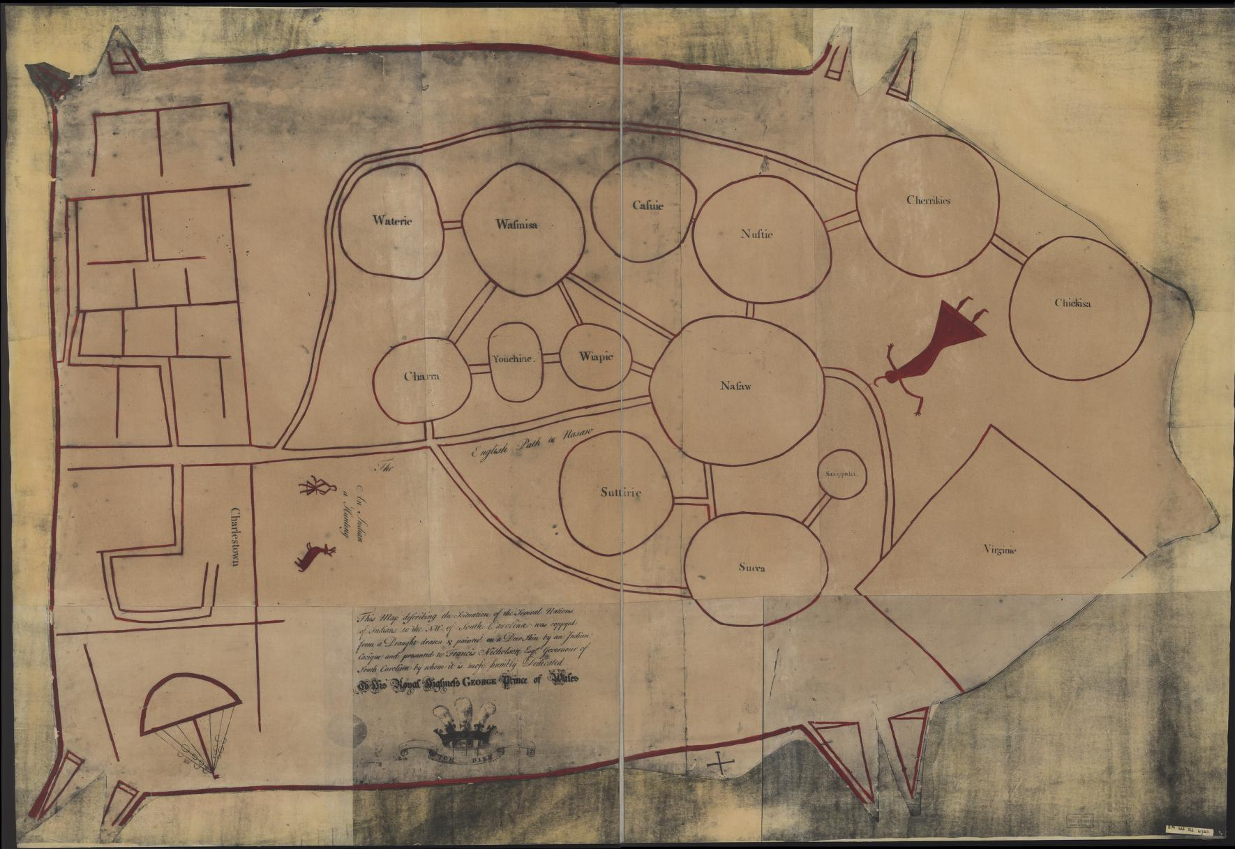
c. 1721 design; LOC reproduction, 1929 · Represented historical people
Catawba deerskin map: archival reproduction
Unidentified Indigenous maker; colonial copy associated with Francis Nicholson
Cherrikies appears in the upper-right circle. Newberry explicitly identifies Cherokee among these represented communities. The link concerns historical representation.
Underlying mapmaker and colonial copyist unnamed. Supplied digital reproduction; exact scan provenance unconfirmed. Historical interpretation: Library of Congress and Newberry Library. Archive reuse and provenance notes ↗
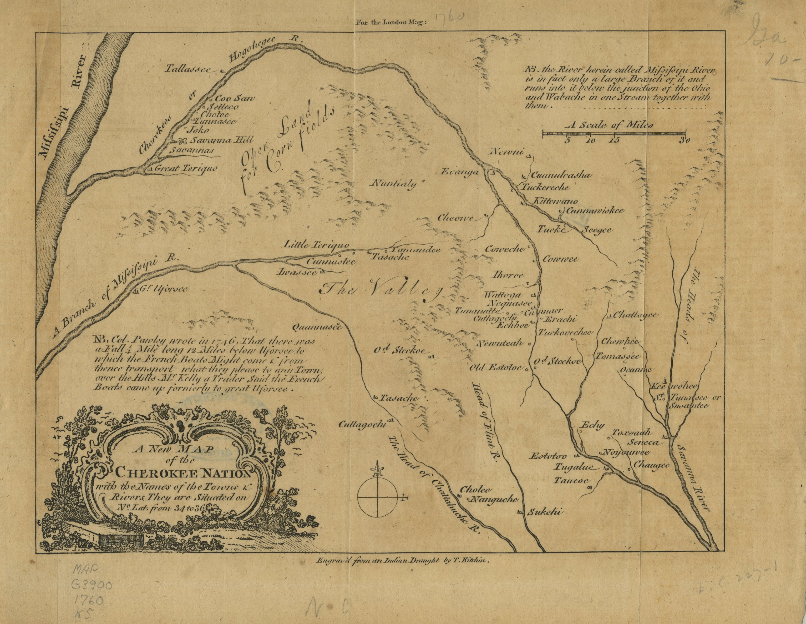
1760 · Named subject of historical map
A new map of the Cherokee Nation
Thomas Kitchin (engraver); unidentified Indigenous draught credited on the sheet
This engraving depicts Cherokee towns and rivers in 1760. Its title identifies the Cherokee Nation, without assigning the map to a single present-day Cherokee government.
A new map of the Cherokee Nation, 1760, hmap1760k5, Hargrett Rare Book and Manuscript Library, University of Georgia Libraries; presented by the Digital Library of Georgia. Engraved by Thomas Kitchin. No Copyright — United States ↗
These map connections are a growing selection. Historical depictions do not establish current boundaries, and a link does not imply community authorship or endorsement.
Follow the reading path
Sources & further reading
Open any title to read the original source. Annotations explain what each link can help you explore.
No Indigenous-led source is identified in this entry yet. This is a gap in this collection, and does not imply an absence of community knowledge or organization.
Community or Indigenous-organization perspective linked for this entry. Use “Cherokee Nation History” to begin with the publisher’s own account; check whether its scope is one community or a wider people.
Community or Indigenous-organization perspective linked for this entry. Use “Cherokee Nation: History” to begin with the publisher’s own account; check whether its scope is one community or a wider people.
Community or Indigenous-organization perspective linked for this entry. Use “Cherokee Nation: Language Programs” to begin with the publisher’s own account; check whether its scope is one community or a wider people.